Client Information
Laser scanning
LiDAR
360˚Imaging Technology
Asset digitisation
BIM at LOD400
Point Cloud with image navigation
Constructed over a century ago, Walka Water Works holds significant historical importance having provided water and electrical services to the Maitland region. Since the Works' decommissioning in 1976, council has been working to preserve the both architectural and engineering heritage while re-purposing the site to continue to benefit the region.
CONTEXT
Recognising the need to document the historical significance of Walka Water Waters, Maitland City Council engaged our services to preserve the legacy of the site. This initiative aimed to facilitate architects, planners, and engineers in exploring options for restoration and redevelopment.
SOLUTION
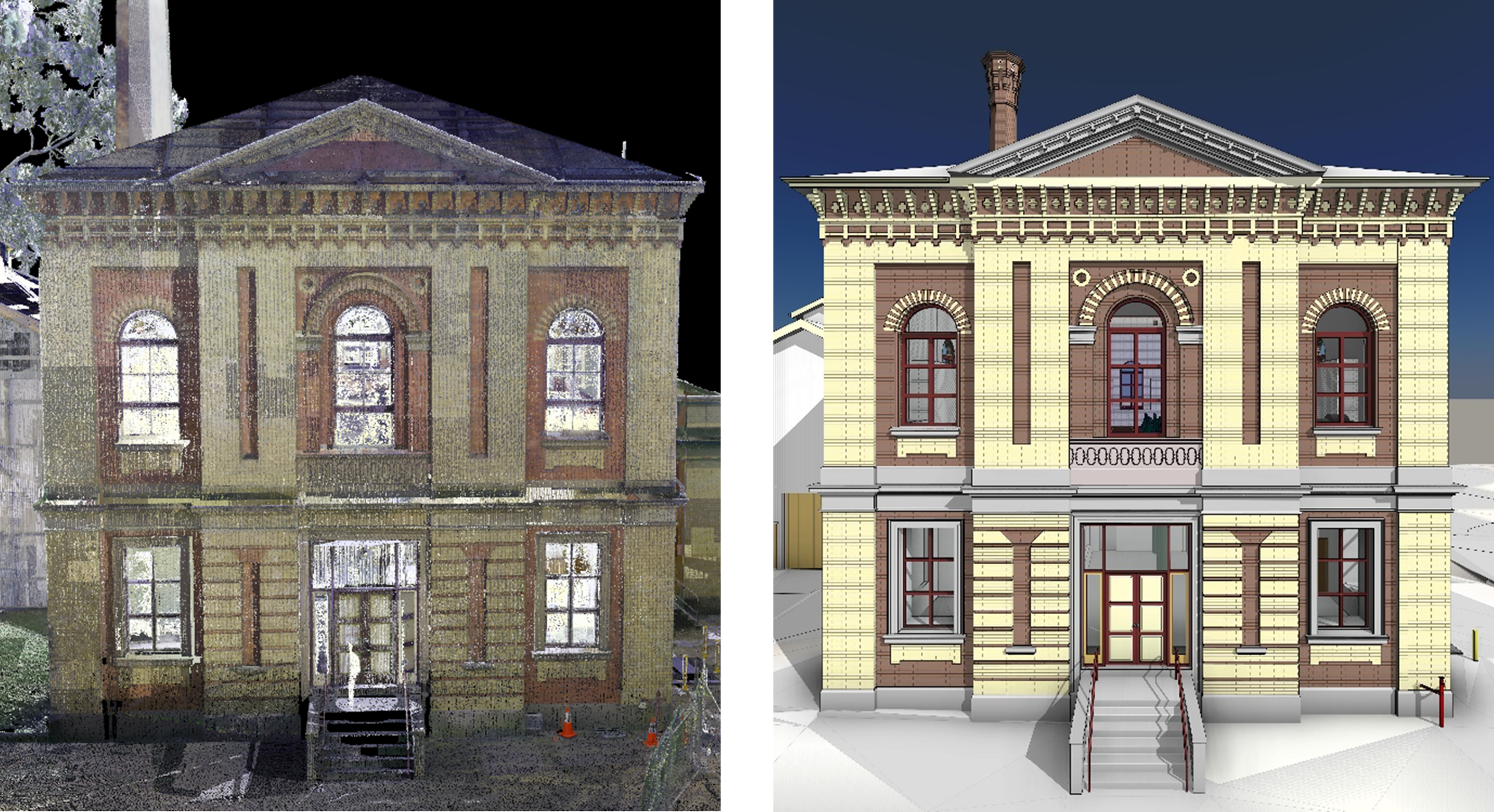
With our expertise in survey and scanning, we utilised state of the art LiDAR and 360° imaging technology to scan the building, generating a point cloud with ±10mm accuracy. This scan produced a colourised point cloud with image navigation, providing detailed representations of both the internal and external structure of the building.

Using this point cloud data, we created a Building Information Model (BIM) at Level of Detail (LOD) 400, capturing the intricate Victorian industrial architecture of the building; including the complex brickwork, architraves, vintage pump equipment, and other site structures and services.
OUTCOME
Our team scanned Walka Water Works in just three days, producing 3D deliverables to create a point-in-time digital twin of the site. These products serve as a valuable asset for managing the site into the future, providing stakeholders with a detailed virtual representation to aid in making decisions for maintenance, preservation, and future utilisation of the site.
The accessibility of our models promotes stakeholder collaboration by allowing remote access to complete virtual site inspections and real-time collaboration from any location. Planners, architects and engineers can leverage the 3D models to explore options and assess the feasibility of designs, ensuring that proposed changes align with strategic objectives throughout the lifecycle of the asset.
We deliver the highest quality outcomes to clients in NSW with our specialised surveying, town planning, laser scanning and project management services, produced by an industry-leading team.