3D Spatial Services
Monteath & Powys specialise in capture, management and delivery of 3D and Spatial data. As one of the first firms in NSW to adopt 3D Laser scanning, Monteath & Powys have developed a specialised 3D Spatial team with expert knowledge and experience working across all sectors and projects of all sizes.
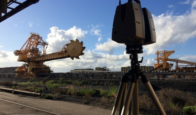
Monteath & Powys 3D data capture capabilities allow for rapid contactless data acquisition utilising a wide range of measurement methods including 3D Laser Scanning, Aerial Photogrammetry, LiDAR and Metrology.
We have extensive experience in the management and integration of large scale and government data sets creating custom solutions, supported by onsite survey ensuring quality and spatial accuracy.
3D Laser Scanning
3D BIM
3D Building Information Modelling can be provided across a variety of software packages at a level of detail (LOD) tailored to the project and clients’ requirements.
Monteath & Powys are experts in the data acquisition and management to produce BIM systems on any scale, ensuring a unique and tailor-made solution to suit individual project needs.
Services

Building & Infrastructure Digital Twin
3D Digital Twin for efficient asset management and design within a virtual space. Data acquisition, model development & maintenance.
Site digitisation
Digital representations of any structure or mechanical system no matter the size and complexity.
Modelling to all levels of detail (LOD)
Tailor-made solutions with level of detail (LOD) to clients’ specifications ranging from simple block modelling to highly detailed LOD 500 models.
As-built modelling and clash analysis
3D Survey data allows direct comparison between existing and proposed designs. Our Spatial team specialise in Clash Analysis combining real world & design data.
3D deliverables in industry standard software
Production of 3D models in a variety of formats tailor-made to client and project requirements. Effective integration of data into design or asset management systems.UAV Capture
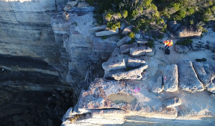
Monteath & Powys have a number of UAV pilots with full CASA accreditations. Providing 3D aerial models along with aerial photography, site inspections and progress monitoring.
Our 3D Spatial team are specialists for UAV work in complex environments & restricted airspace, with extensive experience working with the RAAF for operations within military controlled airspace.
Monteath & Powys UAV based photogrammetry and 3D Modelling is supported by onsite survey, ensuring the highest data quality and spatial accuracy available.
Services

CASA accredited UAV operators
CASA commercial operations accredited organisation, fully trained and experienced pilots with extensive survey backgrounds.
Aerial photography
Aerial photography using a variety of methods including UAV, helicopter and fixed wing depending on the size and location of the project.
Industrial inspection works
Photography and video capture for industrial inspections in inaccessible or high risk areas.
Volumetric surveys
Capture of stockpiles, excavation and earthworks to create a high resolution 3D models. Volumetric analysis with a high level of detail based on complex meshing of the irregular surface.
Ground modelling
Aerial photography and creation of 3D models using photogrammetry allowing ground modelling and analysis, including ongoing monitoring and change detection.High Precision Metrology (Industrial Measurement)
Monteath & Powys are industry leaders in high precision metrology achieving sub-millimetre results on a range of complicated projects and structures. Projects range from precise alignment surveys, check surveys on precise machinery and monitoring of objects and structures with sub-millimetre accuracy.
Monteath & Powys can provide onsite metrology support for all stages of a project including design, fabrication, installation and commissioning.
Our team also specialise in large scale dimension control for fabrication projects such as steel bridges, oil rigs, transfer chutes and large vessels.
Services

Sub-millimetre metrology surveys
High precision surveys using a variety of high accuracy metrology grade instrumentation.
Sub-millimetre laser scanning
Use of hand-held laser scanning devices to create point clouds & 3D models with sub-millimetre relative accuracy.
High accuracy movement monitoring
High precision monitoring with sub-millimetre relative accuracy for detection and monitoring of machine and plant movement.
Precise alignment surveys
Alignment of machined components with a high confidence in sub-millimetre results.Spatial Data Management
Monteath & Powys lead enterprise spatial digital transformation, offering interactive digital twins for your site accessible on any device. We are experts in integrating GIS and asset systems to ensure accurate, up-to-date data through automation.
We are committed to delivering tailored solutions using industry standard GIS software. Using our specialized skillset in large spatial dataset manipulation, we can create complex and efficient data models to manage accurate GIS frameworks for your specific needs.
Services

Enterprise spatial digital transformation
Transform your organisation by spatially enabling your team with the power of location.
Interactive spatial digital twins
Site scale interactive spatial digital twins for visualization, analysis, and planning.
Cloud-based web and mobile platforms
Fast and flexible access to spatial information anywhere, anytime, on any device with cloud rendering.
Asset system integration
Integrate and automate GIS and asset management platforms to spatially view information-rich asset data.
Quality assurance of existing data sets
Ensure integrity and accuracy of spatial data through automated QA/QC workflows for better decision making.
Industry standard deliverables
Delivered using industry standard GIS software into any system tailored to project requirements.GIS
Geographical Information Systems provide the framework to compile, store, analyse, and display spatial data in customised databases specific to clients’ needs.
With our strong background in surveying and spatial data management, Monteath & Powys provides expert development and management of highly customised GIS frameworks with a great deal of confidence in the spatial accuracy and reliability.
Monteath & Powys can create a wide variety of spatial database formats to store and maintain on your behalf, or issue to our clients for their ongoing use.
Services

Custom GIS solutions
Obtaining, verifying and compiling site specific data for the creation of customised GIS databases.
Linked documents for easy access
Hyperlinking of specific documents to the subject matter. Allowing rapid document retrieval and spatial connection.
Incorporation of customised survey data with government data sets
Verifying large scale & government data sets with survey accurate information. Capture and overlay of unique field data for individual sites. Multiscale datasets developed.
Industry standard deliverables
Monteath & Powys' GIS experts are proficient in the use of industry standard software packages and provide custom made deliverables ensuring easy integration.Underground Utility Mapping
Monteath & Powys specialise in the compilation & maintenance of underground utility data with presentation in a spatially accurate environment.
In addition to asset owners plans and records, we utilise a number of industry partners to obtain service location through means of electronic location, ground penetrating radar and positive identification providing the data to the Australian Standard classifications under AS5488.1:2019.
Services

Underground utility mapping
Location of underground services with presentation in spatially accurate plans & 3D models.
Creation of 3D service coordination models
Processing of service model information in 3D allows visualisation and design. 3D service coordination minimises construction & maintenance times.
Site specific data standards
Custom service location & identification for site specific requirements including Defence and government authorities.
Defence site GFIS mapping
Specialising in Defence utility mapping and outputs as per the Defence Spatial Data Management Plan.
Sydney Trains DSS
Monteath & Powys are AEO accredited and fully aware of all ASA Standards for DSS mapping.