Client Information
Asset modelling on large sites and land holdings
LiDAR capture and analysis
Constraint analysis for planning
Ground modelling
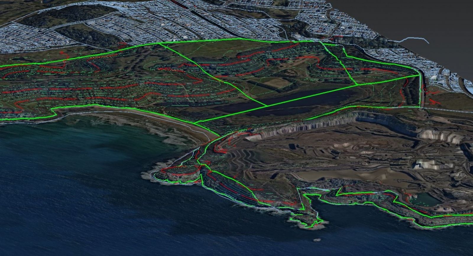
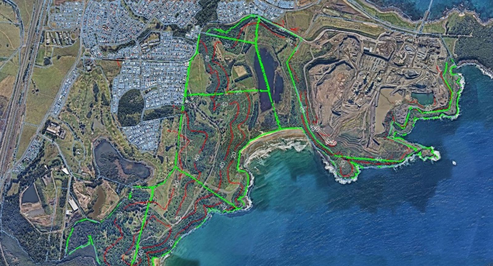
Monteath & Powys' client was looking to develop a steep site on the NSW south coast, the 3D Spatial team prepared a concept model for the feasibility study and initial concept design using a combination of recent government data sets.
With a 3D model created from aerial LiDAR the topography of the site is quickly understood. The 3D model was textured using a high-resolution aerial image creating a realistic 3D visualisation model of the site and surroundings, greatly assisting with initial architectural concepts and visualisations for DA submission.
Overlaying constraint mapping such as boundaries, slope analysis, and waterways allows for rapid desktop-based constraint mapping without the need for site survey. This model is directly compatible with industry standard GIS systems and will provide the base model for our clients GIS model of this site.
This 3D site model will be progressively updated as the project develops with the addition of survey data to tighten up the accuracy and develop a model suitable for the detailed design phase.